Panama flood & climate risk intelligence
Before you spend
$200,000
on a Panama property —
spend $79
checking the risks.
Drop a pin on your property. We check the location risks that could cost you tens of thousands later.
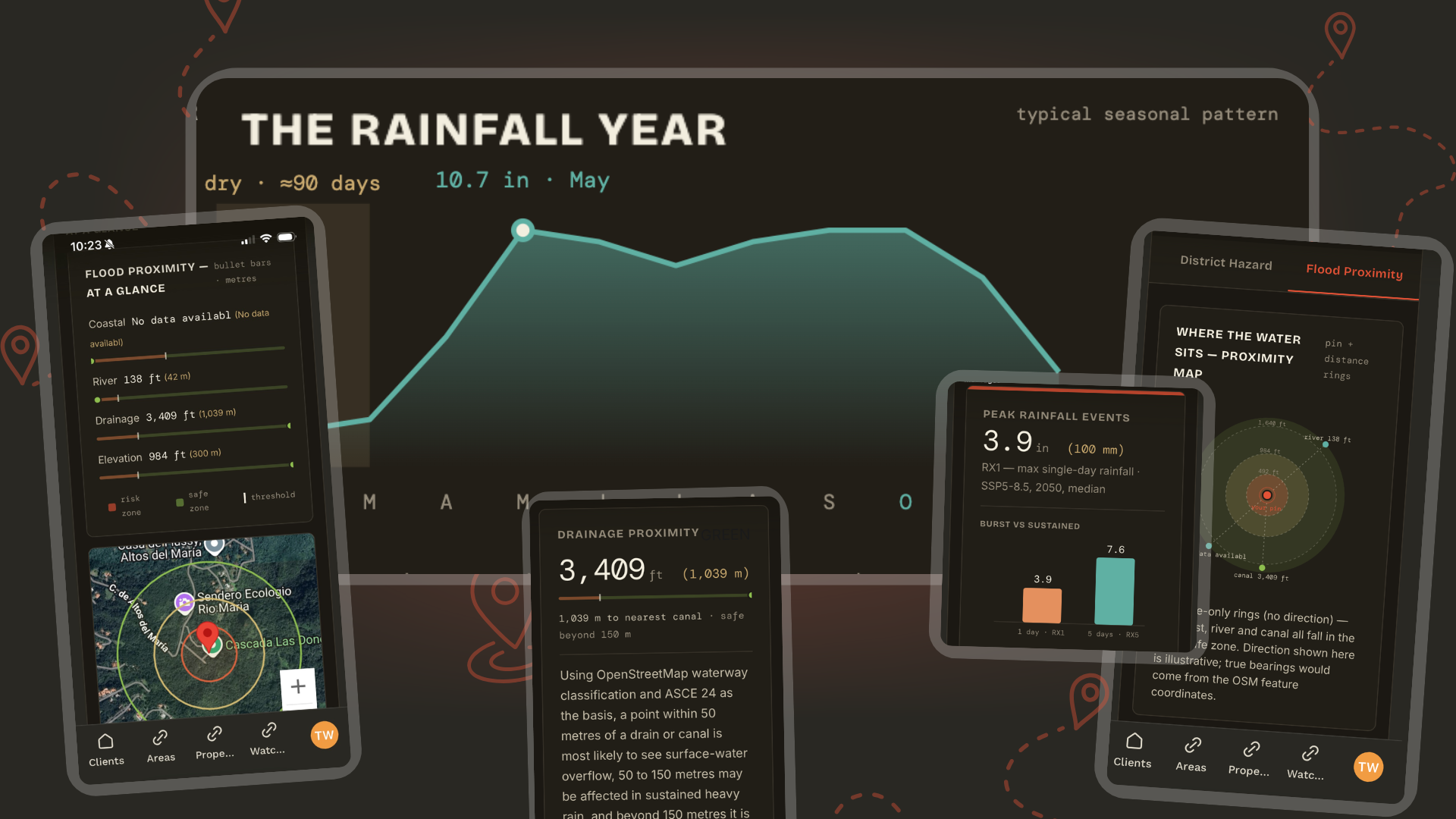
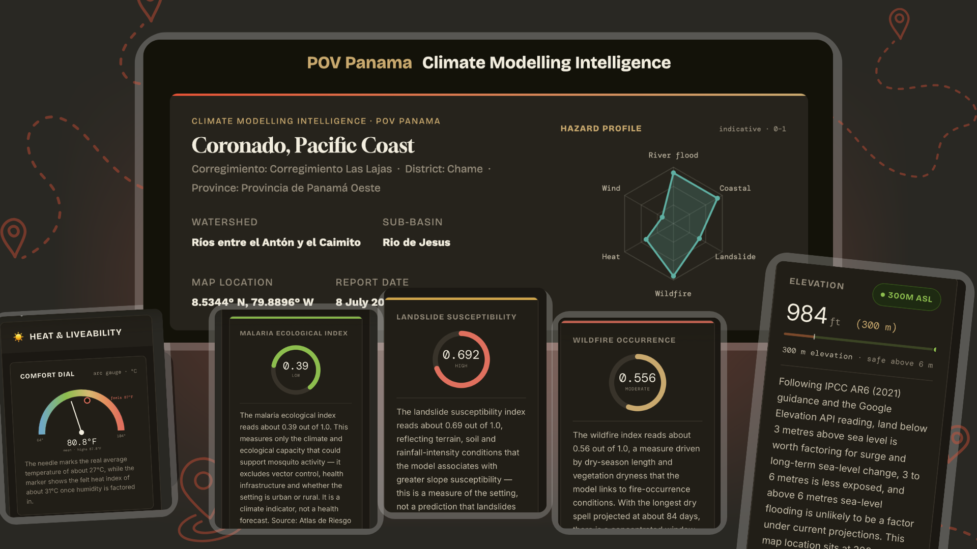
POV Panama’s Flood & Climate Intelligence looks at the exact location you are considering and gives you a private dashboard showing the climate, flood, drainage, elevation, rainfall, heat, wind, wildfire, landslide, and location-risk signals around that pin.
▸ Panama · click the map to drop your pin
Click the map to drop a pin
Elevation
38m
Flood proximity
142m
Secure Stripe payment · Delivered fast to your inbox
The problem
Panama's location risks are
hard to nail down.
The data is built for scientists,
not for you.
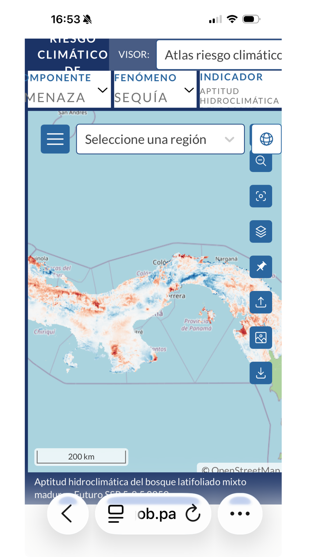
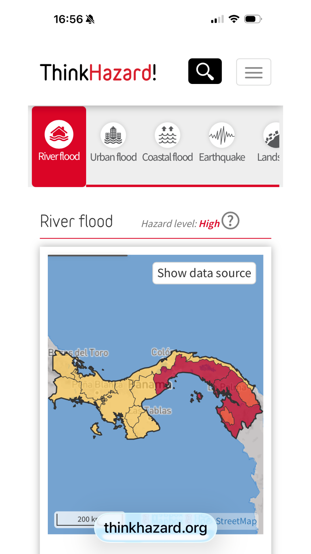
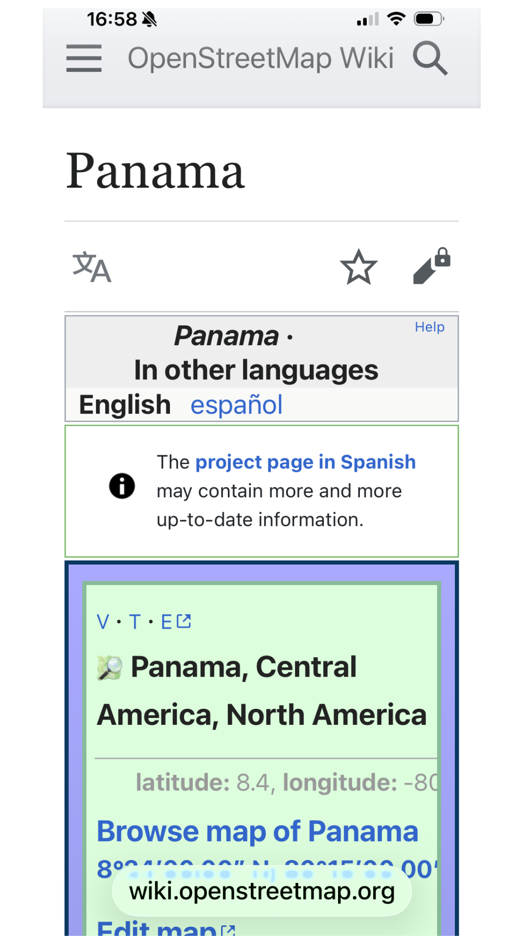
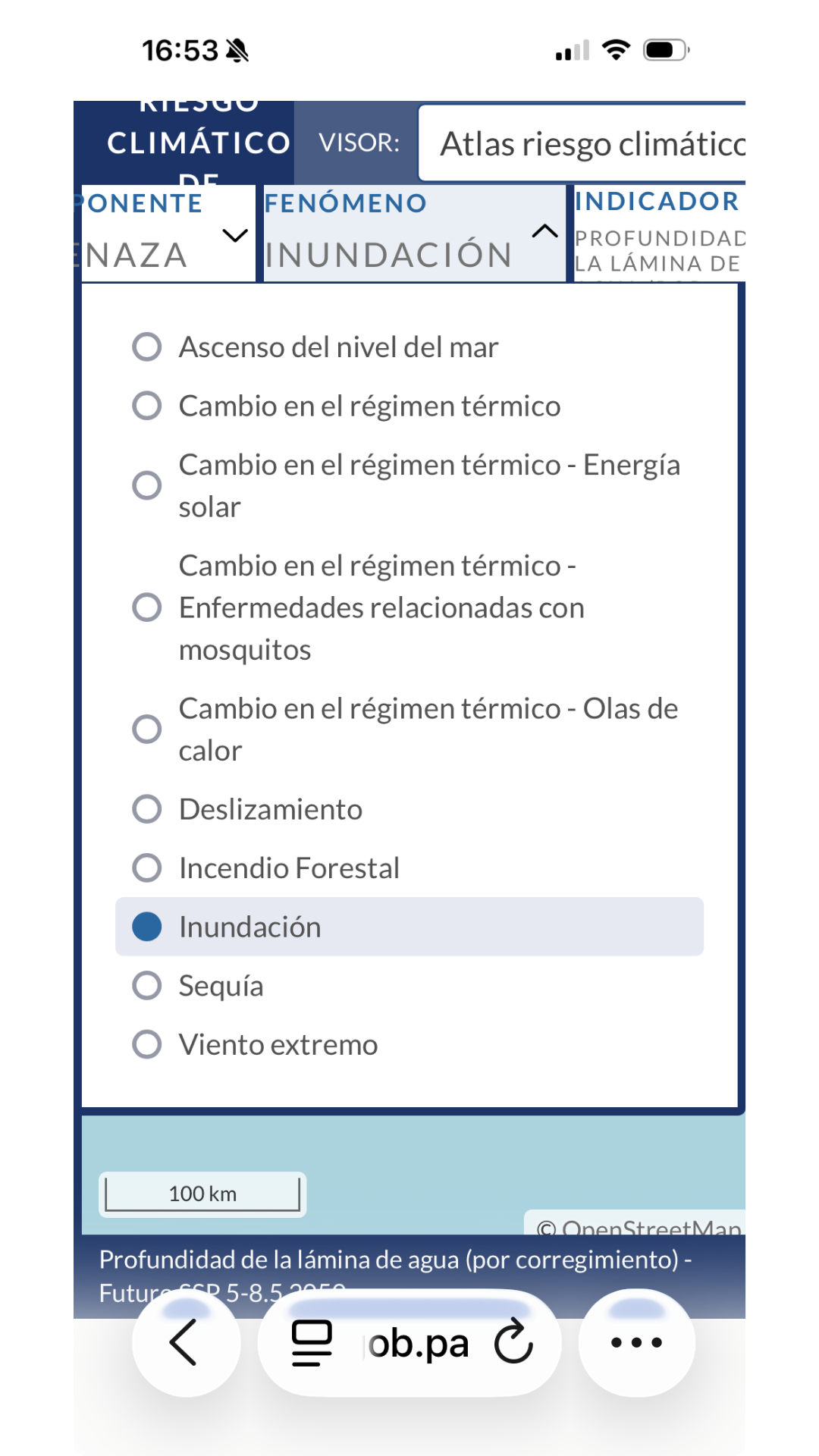
Panama's flood and climate data is spread across government models, hazard databases, elevation tools, map layers, rainfall records and local sources. Some of it is technical. Some of it is in Spanish. Much of it applies to
an entire district, not the property you are considering.
POV Panama brings those separate sources together around
one property pin
. Our dashboard brings in flooding, rainfall, heat, wind, wildfire, landslide and available future climate modelling. Then it explains the findings in plain English and gives you the questions to ask next.
The choice
You could spend
days
opening maps, translating documents, comparing datasets and working out which information applies to the property in front of you.
15 minutes.
Or open one dashboard and understand the key risks.
✓
Exact property pin analysed
✓
Public and government data sources
✓
Plain-English risk explanations
✓
Independent of the property sale
What You Get
25 Risk Signals.
Your private intelligence dashboard
Take a look inside
01
Flood Risk
02
Inundation Risk
03
Climate & Natural Hazards
04
Panama 2050 Projections
05
Property Due Diligence Questions
01
Flood Risk
See how close your chosen location is to rivers, streams, drains, canals or the coast—and whether flooding has been recorded or modelled nearby. A property may look dry in listing photos and still sit near a drain, low road, watercourse or poorly draining area that deserves more investigation.
We show peak rainfall in the area, so you can assess the adequacy of property downpipes, gutters and nearby street drainage.
Delivered in your private POV Panama dashboard with clear visuals and straightforward explanations.
Your report image
1080×1920
Sneak peek
Flood proximity
142 m
02
Inundation Risk
We measure property elevation & coastal proximity, so you better understand the risks of inundation based on scientific standards. Find out how high your pinned location sits and whether distance to the coast could matter during heavy storms or coastal surge.
Shown with pin-level elevation, proximity measurements and green, amber or red indicators where available.
Your report image
1080×1920
Sneak peek
Elevation
38 m
03
Climate & Natural Hazards
See the actual rainfall, climate and hazard signals tied to this exact location: how much rain it gets, how hot it runs, whether wind exposure is a factor, and whether wildfire, landslide or coastal risks show up in the available data.
Instead of a vague list, you see which of these risks are present here, which are not, and which ones are worth asking about before you move forward.
You see exactly which risks matter for this property, how serious they are, and whether they could affect your decision to buy, live in, rent out or insure it.
Your report image
1080×1920
Sneak peek
Hazard level
Amber
04
Panama 2050 Projections
See what the government climate modelling suggests about future flood and climate pressure around your pinned location.
You are not just buying a property as it looks today. You may be choosing a home, investment or retirement base you expect to hold for years.
You'll see the available government modelling on whether flood or climate risk is likely to rise here—and how reliable that data is—so you can decide if it's a risk you're willing to take.
Your report image
1080×1920
Sneak peek
2050 outlook
Rising
05
Property Due Diligence Questions
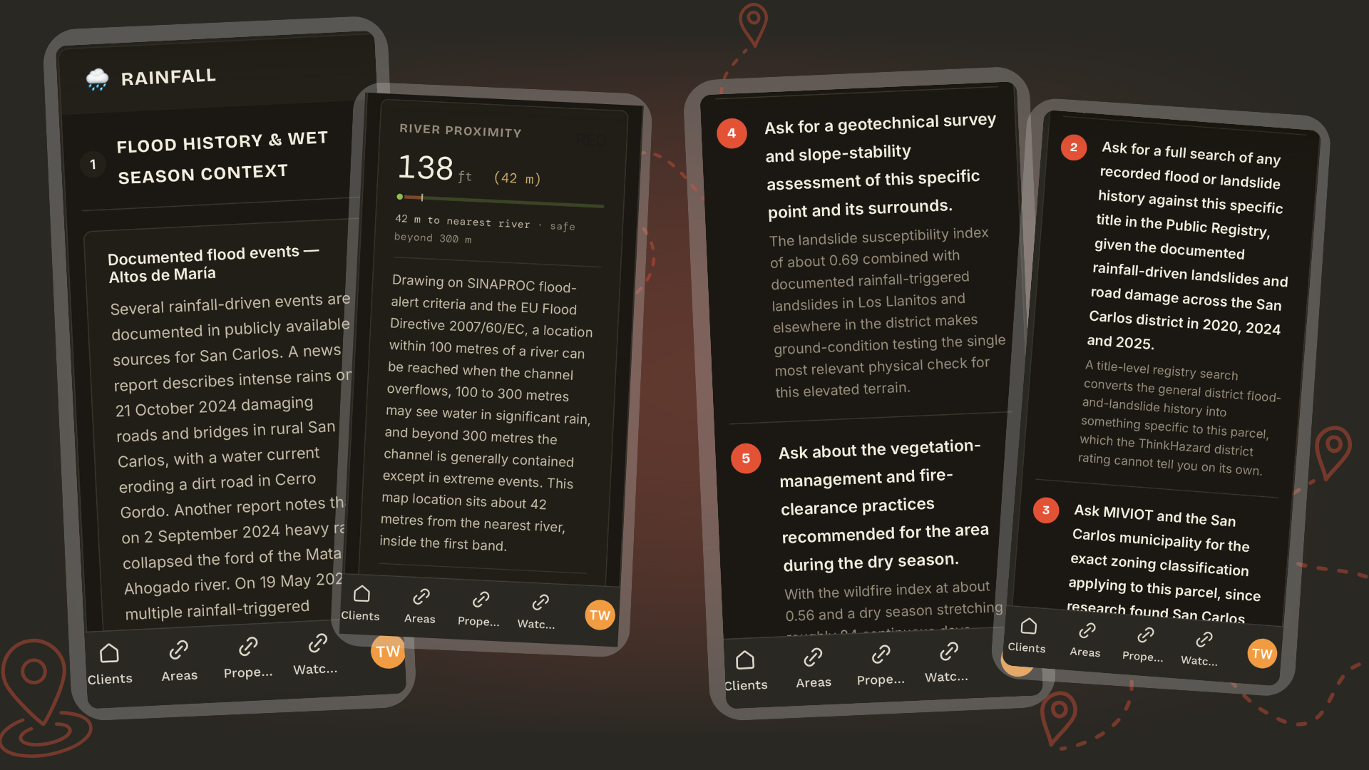
Turn your intelligence into action. Your dashboard gives you direct questions to take to the agent, lawyer, engineer, architect, insurance broker, municipality, developer, property manager or local contact.
When it's time to get the professionals involved, you'll know what to say.
Delivered as a property-specific “What to Ask Next” checklist inside your dashboard.
Your report image
1080×1920
Sneak peek
Checklist
6 questions
25+
Location and climate signals checked
One dashboard. One property pin.
5
Independent data systems brought together
Including Panama government climate modelling.
3
Future flood scenarios tested
Across 10-year, 50-year and 100-year events.
6
Property-specific questions to ask next
So you know exactly what to investigate before buying.
The listing tells you what the seller wants you to see.
POV Panama checks the location around it.
When the decision becomes real, you cannot afford to guess about local flood zones and climate risks.
You have found a home that could become your life in Panama. The photos look right. The area sounds right. You may be planning an inspection trip, talking to an agent from overseas or picturing yourself living there. This checks whether the location has flood, drainage, heat, access or climate signals worth questioning before you build the move around it.
The numbers may work on paper. But a property with wet-season access problems, drainage exposure, flood concerns, extreme heat or harder insurance questions can become a very different investment from the one shown in the listing. This checks the location risk that could affect occupancy, maintenance, resale and the property's long-term appeal.
You are making a local property decision from thousands of kilometres away. You cannot see how the road behaves in heavy rain. You may not know which questions locals ask, which government sources exist or what the surrounding terrain means. This gives you an independent layer of intelligence before you rely on the seller, listing or agent alone.
A note from the founder
A note from the founder
I bought two properties without understanding their flood risk. When the land around my home flooded, I learned how much the right information could have changed those decisions.
The problem was that the information was buried in technical geospatial maps built for town planners, engineers and environmental scientists—not ordinary property buyers.
Renovation Queen
My Master of Environmental Science later gave me the skills to understand that data and turn it into something buyers can actually use.
And then I found Panama. And recognised a pattern that threatened to repeat itself.
So, I built this risk dashboard for me. And now I'm making it available to anyone in the same position.
Tara
Master of Environmental Science · Solar & Battery Energy Expert · Successful Property Investor · Multi-property Airbnb Business Owner · Panama enthusiast
Master of Environmental Science
Solar & Battery Energy Expert
Real Estate Investor
Multi-property Airbnb Business Owner
Panama enthusiast
Former Diplomat to China
Freedom Maximalist
"Now I wouldn't consider property in Panama without running a pin on it first."
And neither should you.
Tara
Master of Environmental Science · Solar & Battery Energy Expert · Successful Property Investor · Multi-property Airbnb Business Owner · Panama enthusiast
Spend less than the cost of a dinner out to avoid the unnecessary heartache of buying blind.
A private intelligence dashboard for the exact location you're considering. Avoid days of wading through complicated geospatial data and online research.
Check the Pin →A home can look perfect in photos and still sit near flood-prone land, unstable slopes, exposed coastline or areas with a history of severe weather.
Government maps, United Nations datasets, technical documents and historical records — the available evidence gathered around one property location.
No need to interpret hydrology maps, environmental datasets or Spanish-language records yourself. The signals are explained clearly, without jargon.
The building is only part of the decision. Investigate the environmental setting around the property before you buy, rent or invest.
Signals, information gaps and areas of concern are highlighted — so you know exactly what to raise with an engineer, surveyor, insurer, lawyer or inspector.
Sellers and agents are there to complete a transaction. This is an independent source of location intelligence that isn't tied to the sale.
When several properties look suitable, consistent flood and climate information makes it easier to compare locations objectively.
Foreign buyers often decide before they can inspect. Get a clearer view of the location while you're still researching from another country.
Flooding, poor drainage and landslides can affect repair costs, access, insurance, resale value and the everyday use of a property.
It doesn't tell you whether to buy. It gives you more of what you need to decide what to investigate, what to question and whether the property still deserves your attention.
You can with a lot of time and effort — but most people don't.
The information exists across multiple government agencies, United Nations datasets, technical maps and historical records. Much of it isn't written for overseas property buyers, and much of it isn't easy to interpret. And most of it is in Spanish.
Flood & Climate Intelligence brings those sources together around a single property location, translates technical information into plain English and highlights the signals that deserve closer investigation.
Instead of spending days trying to work out what matters, you receive one clear view of the available evidence with AI intelligence. And it's ready the same day, in your private dashboard.
No.
No one can honestly guarantee that a property is completely free from flood or climate-related risk.
Flood & Climate Intelligence is designed to help you make a more informed decision by identifying available environmental signals and showing where further investigation may be worthwhile.
Think of it as another layer of due diligence — not the final answer.
If significant signals are identified, you'll know what questions to ask before committing to a property.
When you're spending hundreds of thousands of dollars on property, the cost of missing important information can be far greater than the cost of checking.
Most buyers only discover environmental issues after they've already committed to the purchase — or never investigate them at all.
Flood & Climate Intelligence helps you screen risks, with more information than you had before. It combines trusted public data, independent AI analysis and location-specific intelligence into one place, so you can investigate potential issues before they become expensive surprises.
One small investment into better information can help you avoid a much larger mistake.
Flood Proximity Intelligence is a preliminary screening that checks a property location against selected flood-related maps, records and datasets. It identifies signals that may warrant further investigation before a customer commits to a property. It does not certify whether a property will or will not flood.
It shows flood source proximity, rainfall, elevation, hazard and other available location-risk signals around the exact map pin you submit.
The dashboard helps you see what deserves more investigation before you buy, invest or relocate.
This report does not tell you if a property will or will not flood.
We pull together the information, data and modelling that IS available for your specific area, from multiple sources like Panama Government climate mapping. We combine that with geospatial data, to screen your pin and alert you to potential for flooding signals.
Some results are measured from the exact pin. Other results come from government's own district, watershed or regional datasets.
The dashboard clearly separates pin-level measurements from wider-area risk so you can understand what each result actually says.
Your dashboard gives you risk screening information. It helps you decide what needs investigating further. It must not be used as the sole basis for purchasing, renting, developing, financing or insuring a property, or as a substitute for property-specific professional due diligence.
No.
Green means the available measurement sits outside the main concern band used for that hazard. It does not mean flooding or another hazard is impossible.
The report is designed to show risk signals and is not a flood assessment. It does not issue a safety guarantee.
Amber means the result sits in a middle band where the issue may matter under certain conditions.
It does not automatically mean the property is a bad buy. It means you should ask more questions and investigate further before treating an issue as settled.
It means the Panama Government flood model did not return a flood-depth value at the selected coordinate for that scenario. The Government models are some of the most complete for Panama, but they don't cover the whole country.
'No inundation modelled' does not mean flooding is impossible. The area may not have been studied yet.
Yes.
One property may sit higher, closer to a river, further from the coast, beside a drain or on a different part of the slope.
This is why our intelligence checks a location pin rather than relying only on the town or district name.
No.
It does not replace legal advice, engineering advice, hydrological surveys, insurance advice, legal checks, title search, valuation or physical inspection.
This is a risk screening product. It helps you identify what needs more checking and gives you better questions to take to the right professional.
You need the exact property location.
Use the listing pin, Google Maps location or precise coordinates. The closer the pin is to the actual location you're interested in, the more useful the pin-level measurements will be.
The listing shows the dream.
For less than the cost of a dinner out, check the location risks that could cost you tens of thousands later.